Translate

Saturday, December 14, 2013

The Old Great North Road

Wisemans Ferry NSW. Australia

An easy 14 km. walk over part of this historic road. We parked at the picnic area on the village side of the river and took the car ferry, there is room for hikers on the ferry. The first 3 kms. is uphill but nothing too difficult. We took the short option via Finch's Line but there are many options, it is also quite a good route for mountain bikes, some technical bits but also has some good quality bush and fire trails. The MTB route is approximately 27 kms.

The following detail is from the NSW Government Environment & Heritage website, click here to access that webpage.


The Great North Road, surveyed in 1825 and completed in 1836, was constructed using convict labour. Up to 720 convicts - some in chains - worked on the road, which spanned 264 km, connecting Sydney to the settlements of the Hunter Valley. It features spectacular and beautifully preserved examples of stonework, including buttresses, culverts, bridges and twelve metre high retaining walls.
Unfortunately the road was not popular. It was isolated, had no permanent watercourses, and bypassed existing settlements. By 1836, as the few remaining convict gangs were completing the last northern sections of the road, it had been almost entirely abandoned as a route to the Hunter Valley. Coastal steamers became the preferred mode of travel and transportation.
Only 43 km of the road remains undeveloped and relatively intact. Running through and alongside Dharug National Park and Yengo National Park, this section has been named the Old Great North Road. It goes from Wisemans Ferry in the south to Mount Manning (near Bucketty) in the north, and includes the oldest surviving stone bridges in mainland Australia. The road is closed to motor vehicles, but makes a great walk over two or three days - or an exhilarating day's cycle.
Short hiking route via Finches Line

MTB route


Saturday, December 7, 2013

Sydney Summer

Cicada Central.

Summer in Australia usually means weeks of Cicada serenades but this year the planets must have aligned and it must be the magic 17th. year, I have never seen so many. When I was in primary school cicadas were the BitCoin of the day, depending on your skill at catching them you could accumulate great wealth as they could be traded for all manner of good stuff. We now live on the northern outskirts of the city adjoining a national park, cicada paradise.

Closer to the city centre green, brown and yellow varieties were the most common, if you scored a black prince you could trade it for just about anything. Now living in the bush I am wealthy beyond my wildest dreams but unfortunately I have no one to trade with. All we have here are black princes, millions of them.

One tree in our yard is a favourite meeting place, each morning there are hundreds of noisy princes on the trunk doing their best to attract a mate, how the female chooses one with so much noise I don't know.


Wednesday, October 30, 2013

Rheinsteig

320 km. walking path from Wiesbaden to Bonn.

If you feel like a different kind of European holiday the Rheinsteig hiking path is worth considering, 320 kms. of spectacular scenery, in most places high above the UNESCO listed Upper Middle Rhine Valley. There are many tour companies who will book your hotels and carry your luggage between the hotels each day. You can choose to do individual sections or the grand tour.

Having just ridden the cycleway along the river I would do it by staying in Koblenz, that city makes an excellent base, take a train to your starting point and then another train back to Koblenz at the end of the day. If the weather is not good there are plenty of options in Koblenz.

We did two sections, one during the bike ride and the other on the second last day of our stay in Germany. The first was an out and back from St Goarhausen. The path rises steeply from the village passing Kastel Katz until you reach the Lorelei overlook, then back down to the river, crossing to St Goar on the other side and our hotel. The total distance was about 7 kilometres.


The second section was an out and back from Wiesbaden, total hiking distance was 22 kms. We started by taking the 275 bus from the Wiesbaden Hauptbahnhof to the small village of Schlangenbad [snake bath]. This local bus passes many of the main parts of the city, it takes about 35 minutes and costs €3.60 per person. From Schlangenbad we hiked back to Bierbrich and then took another bus the remaing 4 kms. back to Wiesbaden. Along the way we were treated to spectacular views of the Rhine, beautiful forest trails, vineyards and the final few kilometres beside the Rhine until we reached Bierbrich Castle. It was a very enjoyable and memorable day. We had expected to find a small restaurant  in one of the villages for our lunch but even though it was midweek everything was closed until we got close to Bierbrich around 4.00pm.


There is an excellent book available which gives very detailed descriptions about each section, it also gives you a link to GPX files for the various sections. We downloaded those to my Nexus 7 and used the Locus map app. Signposting was good and we only needed to use the GPS a few times. Locus uses maps stored on your device so no wifi or mobile signal is required and it's a free app.

The book is called Rheinsteig Hiking by Ulrike Poller and Wolfgang Todt, it's in English.

Saturday, October 5, 2013

Via Claudia Augusta Bike Path.

Augsburg to Bolzano

After having a few ''rest'' days in Berlin after the Rhine ride we took the I.C.E. train to Augsburg for the start of the Via Claudia Augusta ride. This really is a very special ride, it is not the easiest one that we have done in Europe but the route, towns, cities and scenery make it the best so far. The route follows much of the original route of the Roman road, it includes two mountain passes over the alps but the tour company provides shuttle services to the top of both passes. This is not a group ride, you ride independently, the tour company books the hotels, provides the bikes and carries the luggage between hotels.

Starting in Augsburg where we had two nights we then had overnight stays in Landsberg am Lech, Schongau, Fussen, Imst, Burgeis, Meran or Merano depending on your choice of language and then finishing in Bozen or Bolzano.
The two passes are the Fernpass and the Reschenpass. We were fortunate to have near perfect weather for most of the ride, the first day was overcast and day five we had a headwind for much of that days riding, this was frustrating as we had expected to just roll from Burgeis to Merano, even though it was a gentle downhill we had to pedal for most of the way.

You do need a reasonable level of fitness to enjoy this ride, there is no rest day and even the downhill sections contain a lot of ''ups'' but the scenery makes up for any minor discomfort. There are a few kilometres of gravel trails on the descent from the top of the Fernpass, fun if you like mountain biking but not a big issue if you usually ride on paved paths or roads.
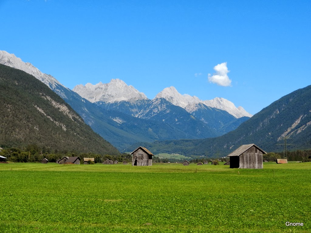


 Landsberg am Lech
 Untermeitingen
 Burggen
 Langenwald 
Langenwald
Fussen is a beautiful town, surrounded by lakes, mountains and even Mad King Ludwigs weekender, Neuschwanstein. Our hotel was in the old part of town so we had a great choice of good and inexpensive [by Sydney standards] restaurants nearby.

 Fussen
 Ober-Pinswang
 Zugspitze on the way up Fernpass
Lermoos
Early morning from our balcony in Imst
The shuttle that takes you to the Reschenpass stops at Nauders so you do have a few kilometres of gentle climbing before you get to the top of the pass, we had perfect weather except for a strong headwind on that section. We were thinking that the ride from the top to that nights destination would be a fun downhill but it was many kilometres of up and down, the scenery was fantastic but it was a tiring end to the day. We did get about 5 kilometres of reasonable downhill before Burgeis but got stuck behind a farmer on his tractor for half of it.

 Reschenpass
 Reschen
St. Valentin
Burgeis is a farming village but with a large good quality hotel, cold beers and a very good five course dinner for €16 finished a memorable day off very nicely. The following day was almost entirely downhill but we had a headwind for more than half of it, endless apple orchards with mountains on either side before finally riding into Merano.

 Glurns
 What do they do with so many apples, millions of them.

Solar panels everywhere in Germany and Italy while Australia with almost unlimited sun burns coal, not the lucky country, the stupid country.

The last day from Merano to Bolzano was on a brand new 50 km. stretch of cycleway. All of the towns along these European bike paths are prosperous because of the huge numbers of bike riders using the hotels, restaurants and shops along the way, while in Australia, building bike paths in the cities is under attack and long distance cycleways in the countryside are almost non existent. Very sad. So many country towns in Australia could really benefit if there were just a few progressive politicians willing to give it a go.

We rode approximately 320 kms. most of the ride was on dedicated cycle paths with just a few kilometres of gravel, signposting was OK but sometimes became confusing when we were trying to find our hotels. A phone with Navfree installed is a good option as that app doesn't need a mobile or wifi signal. The hotels were good apart from the City Hotel in Merano, it was brand new but was next to a busy intersection, no air conditioning, motor scooters and warm weather made for an uncomfortable night.

 Bolzano
Bolzano
Bolzano was having a city party when we were there, they do this every two years. It was a great atmosphere with food, beer, music and thousands of happy people having a good time.


 Our Strauben chef
This was a superb ride, if you are planning to do a ride in Europe check this one out, just make sure you are reasonably fit and you will have one of the rides of your life.

Tuesday, September 24, 2013